


Voting District 140001, Cayuga County, New York
About
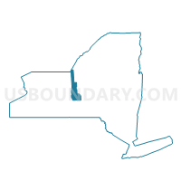
Outline

Summary
| Unique Area Identifier | 625764 |
| Name | Voting District 140001 |
| County | Cayuga County |
| State | New York |
| Area (square miles) | 23.20 |
| Land Area (square miles) | 20.86 |
| Water Area (square miles) | 2.34 |
| % of Land Area | 89.92 |
| % of Water Area | 10.08 |
| Latitude of the Internal Point | 42.82051140 |
| Longtitude of the Internal Point | -76.35926780 |
Maps


Graphs
Select a template below for downloading or customizing gragh for Voting District 140001, Cayuga County, New York


Neighbors
Neighoring Voting District (by Name) Neighboring Voting District on the Map
- Voting District 130001, Cayuga County, NY
- Voting District 140002, Cayuga County, NY
- Voting District 160001, Onondaga County, NY
- Voting District 160007, Onondaga County, NY
- Voting District 170001, Cayuga County, NY
- Voting District 170001, Onondaga County, NY
- Voting District 170002, Onondaga County, NY
Top 10 Neighboring County Subdivision (by Population) Neighboring County Subdivision on the Map
- Skaneateles town, Onondaga County, NY (7,209)
- Moravia town, Cayuga County, NY (3,626)
- Spafford town, Onondaga County, NY (1,686)
- Niles town, Cayuga County, NY (1,194)
- Sempronius town, Cayuga County, NY (895)
Top 10 Neighboring Unified School District (by Population) Neighboring Unified School District on the Map
- Homer Central School District, NY (12,531)
- Skaneateles Central School District, NY (8,945)
- Moravia Central School District, NY (7,584)
Top 10 Neighboring State Legislative District Lower Chamber (by Population) Neighboring State Legislative District Lower Chamber on the Map
Top 10 Neighboring State Legislative District Upper Chamber (by Population) Neighboring State Legislative District Upper Chamber on the Map
- State Senate District 54, NY (302,881)
- State Senate District 49, NY (296,854)
- State Senate District 50, NY (296,761)
Top 10 Neighboring 111th Congressional District (by Population) Neighboring 111th Congressional District on the Map
Top 10 Neighboring Census Tract (by Population) Neighboring Census Tract on the Map
- Census Tract 408, Cayuga County, NY (4,820)
- Census Tract 409, Cayuga County, NY (4,063)
- Census Tract 167, Onondaga County, NY (2,592)
- Census Tract 168.01, Onondaga County, NY (1,686)